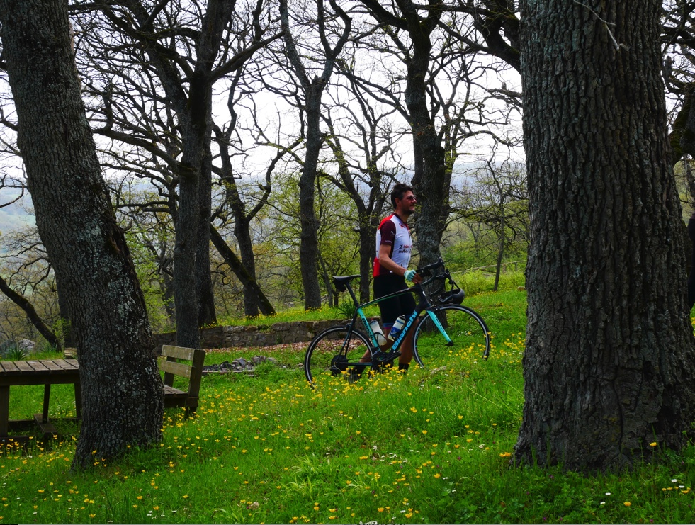
21 - The Foreigners' Road - from Matera to Potenza
Itineraries
Difficulty: medium / high
Bike type: road, gravel, e-bike
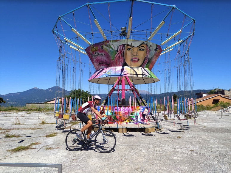
Departure: Melfi – Train Station
Arrival: Melfi – Train Station
Total miles: 112km
Road surface: asphalt and some gravel
Height difference ascent: 1850 m
Height difference descent: 1440 m
Time of year: all year round, best in spring / autumn
Variant:
total distance km 34.8
ascent 860
descent 810
terrain: asphalt
ROUTE
From Matera to Potenza you ride on a path that overlaps the Strada degli Stranieri (“the Route of the Foreigners”) for long stretches, a strategic sheep-track that for millennia had enabled foreigners, the Greeks, to travel from the Ionian to the Tyrrhenian Sea, from the Greek city of Metapontum to that of Paestum.
ROUTE 21
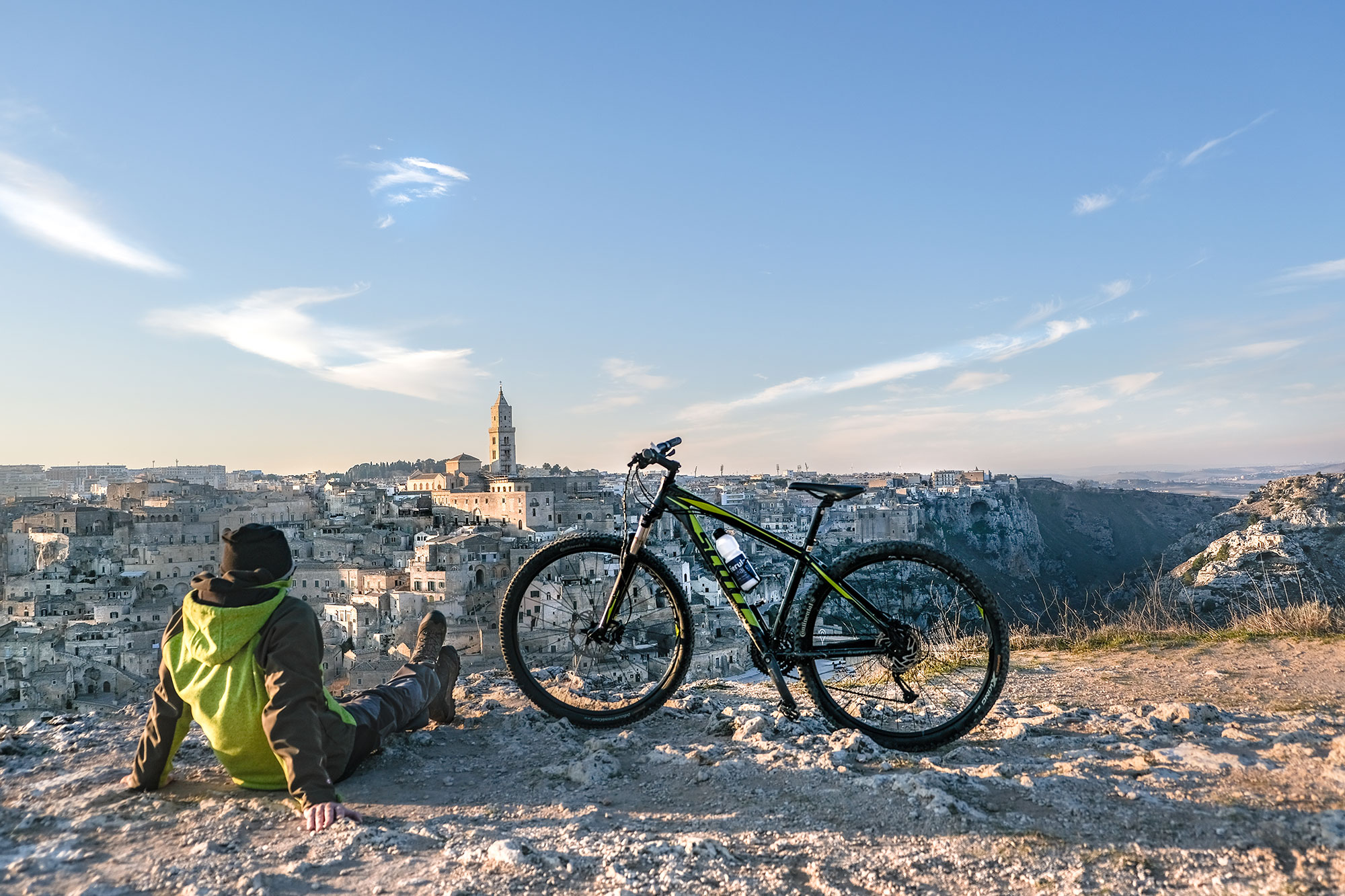
The route, which we suggest to take in 2 stages, starts from the Piazza Vittorio Veneto in Matera, one of the oldest cities in the world and European Capital of Culture 2019. The city is world famous for its Sassi, a World Heritage site since 1993 along with the Park of the Rupestrian Churches.
Leaving the northern outskirts of the city, you approach and skirt Lake San Giuliano until reaching the centre of Grassano, the birthplace of Master Francesco Artese, an internationally renowned nativity scene artist. Continuing on the SS7 state road, after a long climb, you arrive in Tricarico, a town known for its Carnival, recognized as a Historical Carnival of Italy by the Ministry of Cultural Heritage, Activities and Tourism (MIBACT). Climb further up to the Cupolicchio pass
Variation:
Once at the Cupolicchio pass, on the SS7 road, exit to the right to reach Albano di Lucania and then Campomaggiore. Once in the centre of this picturesque village, we recommend a detour to Campomaggiore Vecchio, location of the La Città dell’Utopia (“The City of Utopia”) summer event. The last stop on this extended tour of the villages of the Piccole Dolomiti Lucane (Little Lucanian Dolomites) is Pietrapertosa, known for its Volo dell’Angelo (Angel Flight).
The next stop on the tour is the medieval village of Vaglio di Basilicata, with its archaeological areas, that of Serra, whose plateau was occupied by the Peuketiantes in the second half of the 8th century BC, and that of Rossano, site of the sanctuary dedicated to the goddess Mefitis.
A few more kilometres and you reach Potenza, the highest regional capital in Italy. Elegant and welcoming, the city revolves around its thousand-year-old historical centre, made up of stately palaces and ancient gateways, medieval towers and a splendid central square dominated by the Teatro Stabile, built in 1857 in the image of the San Carlo theatre in Naples.
ROUTE 21 variant

20 - In the footsteps of Giro d'Italia: from the Pollino National Park to Matera
Itineraries
This stage tour retraces much of the stage of the Giro d’Italia that passed through Basilicata in 2020. The last kilometres are those the 2013 Giro d’Italia covered in the region.


ROUTE
The route starts from Rotonda, the gateway to the Pollino National Park, and crosses the entire Lucanian side of the park, amidst unspoilt natural scenery where the thousand-year-old Heldreich’s pine reigns supreme.
After passing through the villages of Viggianello and San Severino Lucano, surrounded by the lavish scenery of the Bosco Magnano, you descend to Francavilla in Sinni and then climb up to Chiaromonte, a treasure trove of valuable objects and papers from China, brought to Basilicata by Ludovico Nicola di Giura, the only Mandarin Mayor in history.
After a long descent, skirting the artificial reservoir of the Monte Cotugno Dam, you reach Senise and from here go up towards San Giorgio Lucano and then reach Valsinni, the romantic village overlooked by the feudal castle where the young poet Isabella Morra was born and lived.
After passing Rotondella, the tour continues towards the beaches of the Ionian Sea, enjoying the natural spectacle provided by the ravines. First stop on the Ionian coast is Tursi, with the splendid Sanctuary of Santa Maria di Anglona, then Craco, the ‘ghost town’, Pisticci and finally Bernalda.
With a moderately demanding climb, you then reach Montescaglioso, famous for the Benedictine Abbey of San Michele Arcangelo and from here, skirting the Park of the Rupestrian Churches, in Matera, European Capital of Culture 2019.
Stage 1 - from Rotonda to Senise
Difficulty: medium / high
Bike type: road racing / gravel / e-bike
Departure: Rotonda
Arrival: Senise
Total miles: 70,2km
Road surface: asphalt
Height difference ascent: 1300 m
Height difference descent: 1560 m
Starting from Rotonda, seat of the Pollino National Park, you cross the entire Lucanian side of the park passing through Viggianello and San Severino Lucano After passing Bosco Magnano you go down to Francavilla in Sinni and then go up to Chiaromonte. Long descent and arrival in Senise, overlooking the Montecotugno dam.
ROUTE 20 stage1
Stage 2 - from Senise to Pisticci
Difficulty: medium
Bike type: road racing / gravel / e-bike
Departure: Senise
Arrival: Pisticci
Total miles: 96km
Road surface: asphalt
Height difference ascent: 1240 m
Height difference descent: 1160 m
From Senise go up towards San Giorgio Lucano and take the old state road 104 Jonio – Sapri which leads to Valsinni, whose castle dominates the river. Continue through orchards and beautiful curves up to below Rotondella, to visit if you have an extra day to dedicate to the trip. Cross the Sinni river and reach Tursi passing by the Sanctuary of Santa Maria di Anglona. When you reach the bottom of the Agri valley (a short stretch with probable traffic), turn off for Craco. We are in the heart of the Calanchi area. The destination of the day is Pisticci, reachable with a series of hairpin bends on the old road, to avoid the long tunnel.
ROUTE 20 stage2
Tappa 3 - Da Pisticci a Matera
Difficulty: medium
Bike type: road racing / gravel / e-bike
Departure: Pisticci
Arrival: Matera
Total miles: 70,6km
Road surface: asphalt
Height difference ascent: 940 m
Height difference descent: 920 m
Starting from Pisticci, cross the Basento at Tinchi until you reach Bernalda. From Bernalda you go down towards the Bradano and cross the bridge over the river (closed to car traffic but accessible by bike). Continue left towards Montescaglioso, reachable with a moderately demanding climb. Leaving Montescaglioso along the Parco delle Chiese Rupestri with a climb that becomes challenging in the last kilometers before reaching Via Lucana, which leads downhill to the center of Matera.
ROUTE 20 stage3
19 - From the loricate pine to the pearl of the Tyrrhenian Sea: from Rotonda to Maratea
Itineraries
Difficulty: medium
Bike type: gravel / road racing / e-bike
Departure: Rotonda
Arrival: Maratea
Total miles: 65 approximately
Road surface: asphalt
Height difference ascent: 1390 m
Height difference descent: 1640 m
Time of year: from April to November
ROUTE
Medium difficulty route with many descents and climbs that are quite pedalable. Traffic almost non-existent in the Park area and then increased especially near the inhabited centers of Lauria and Trecchina.
ROUTE 19
The route starts from Rotonda, home of the Pollino National Park, and ends up in Maratea, the pearl of the Tyrrhenian Sea. It is medium difficulty and can be done in a single day, partly following the Rotonda – Lagonegro cycle path, carved out of the former disused railway of the Ferrovie Calabro Lucane.
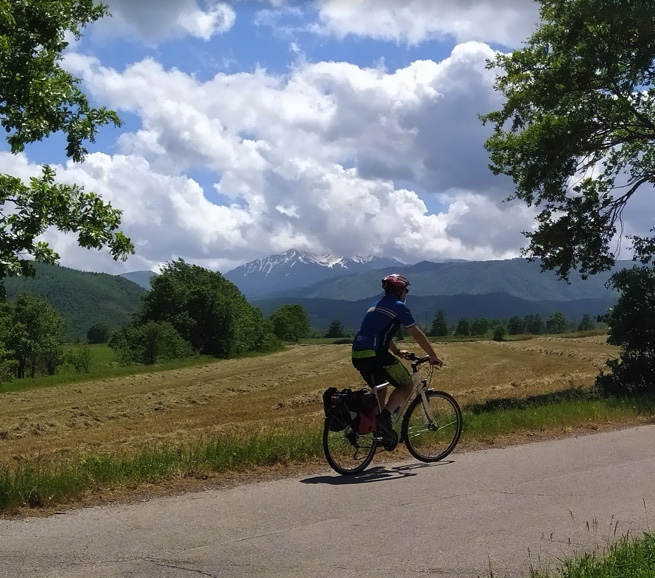
Crossing through the green and wooded areas of the Pollino National Park and following the signs for Maratea, after Rotonda you reach Lauria, behind which rise the peaks of the Sirino massif, an ideal destination for high mountain enthusiasts.
After passing the birthplace of the Lucanian director and actor Rocco Papaleo, beyond Lake Sirino, you leave the cycle path to begin a descent towards Rivello.
Another 9 km of inland road takes you up to Trecchina, where you can stop and visit the historic centre and the sixteenth-century baronial castle, situated on the highest point of the town.
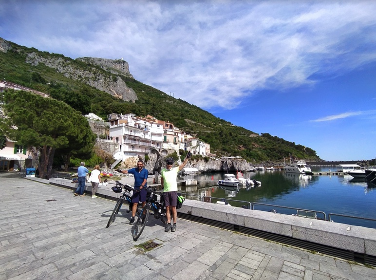
Leaving the town, after about 2 km of climbing, you can look out over the wonderful landscape of the Tyrrhenian coast. Follow the signs for the “Centro Storico” to reach Maratea and end the day in the piazzetta of the old town, among the picturesque alleyways of “the city of 44 churches”.


18 - Cycling in the Pollino National Park, the largest in Italy, a ring-route between rites and myths
Itineraries
Difficulty: high
Bike type: gravel / road racing / e-bike
Departure: Rotonda
Arrival: Rotonda
Total miles: 60 approximately
Road surface: asphalt
Height difference ascent: 1440 m
Height difference descent: 1440 m
Time of year: from April to November
ROUTE
This is a round trip that highly experienced cyclists can complete in a single day, despite the challenging climbs.
ROUTE 18
It starts from Rotonda, home of the Pollino National Park, and after a 25 km climb you reach the plains of Piano Ruggio, at an altitude of 1600 metres. The landscape is constantly changing. In a few kilometres, you pass from Mediterranean scrub to the tall woods which are characteristic of the centre of the Park, oaks and Turkey oaks, giving way to an increasingly dense beech forest.
A stop at the Piano Ruggio fountain will allow you to admire the majestic Serra del Prete, which dominates the plateau. Following the path at the bottom of the valley that plunges into the beech forest on the right, it is possible to take a stroll to the Malvento belvedere, to admire some specimens of Heldreich’s pine clinging to the ridges, at a point where the panorama extends as far as the eye can see over nearby Calabria.
At this point the route becomes more and more rideable, with alternating downhill and uphill sections.. After coming out of the wood, at the end of a 16 kilometre scenic descent through vast grassy meadows, we reach Viggianello, one of the ‘Borghi più Belli d’Italia’ (Italy’s Most Beautiful Villages).
Continue downhill until you reach the valley, and then climb up to Rotonda, the finishing point of this spectacular tour among the highest peaks of the Lucanian side of the Pollino National Park.

17 - Crossing the Pollino National Park, from Terranova del Pollino to Rotonda
Itineraries
Difficulty: medium / high
Bike type: touring / road racing / gravel / e-bike
Departure: Terranova del Pollino
Arrival: Rotonda
Total miles: 58 approximately
Road surface: asphalt
Height difference ascent: 1200 m
Height difference descent: 1200 m
Time of year: from April to November
ROUTE
A mountain route suitable for experienced cyclists, which can be covered in a single day. The tour, at the heart of the Pollino National Park, is characterized by tough climbs but also by enjoyable descents, on roads with very little traffic.
ROUTE 17
Starting from Terranova del Pollino, go up into the shade of the green beech and chestnut woods which are so typical of the area, where it is also possible to admire the extraordinary specimens of the centuries-old Heldreich’s Pine, the symbol of the Park.
Then a pleasant descent leading to San Severino Lucano begins, the destination of one of the most popular pilgrimages in Basilicata, in honour of the Madonna del Pollino.
Variation:
After passing the hamlets of Muscello and Falascoso, about 38 km from the start, you come to a fork in the road. For those who are more athletically prepared, it is possible to continue straight and reach, after about 16 km at 4% of average gradient, the 1600 meters of Piano Visitone and Piano Ruggio and then from there to head on towards Rotonda.
The next stop on the tour is Viggianello, the “town of brooms”, certified as one of the “Most Beautiful Villages in Italy” by the association “Borghi più belli d’Italia”. Another 10 kilometres and you reach Rotonda, where in June i you can watch one of the traditional tree rituals of this area of Basilicata, the Sagra dell’Abete, a propitiatory rite linked to the fertility of the land.
ROUTE 17 variant

16 - From the blue of the Ionian Sea to the green of the Pollino National Park forests
Itineraries
Difficulty: medium / high
Bike type: touring / road race / e-bike
Departure: Policoro – railway station
Arrival: Terranova del Pollino
Total miles: 73 approximately
Road surface: asphalt (some gravel)
Height difference ascent: 1473 m
Height difference descent: 587 m
Time of year: from April to November
ROUTE
This route, designed for moderately experienced cyclists, can be divided into two stages.
ROUTE 16
It starts from Policoro, the ancient Heraclea. The sea and the archaeology, the unspoiled nature of the Bosco Pantano reserve, the fragrance of the famous strawberries and other local produce all accompany the cyclist on this journey through Magna Graecia.
After passing the hamlet of Pane e Vino, skirting the Sinni river, continue in the direction of Rotondella. The village, which can be visited by turning left at the crossroads, owes its name to its round shape and is counted among the “Authentic Villages of Italy” due to its advantageous location.
If we continue straight ahead at the crossroads, we reach Valsinni, the romantic village overlooked by the feudal castle where the young, ill-fated poet Isabella Morra was born and lived.
At this point the cyclist enters the Pollino National Park. The landscape begins to change from low Mediterranean vegetation to mid-mountain vegetation: we are in San Giorgio Lucano.
Leaving the town of San Giorgio, at the crossroads for the SS92, proceeding to the right you reach San Costantino Albanese, an important centre of Arbëreshë culture.
After 10 kilometres uphill, you reach the route’s destination, Terranova del Pollino (930 metres above sea level), an ideal location for the most extreme outdoor activities, such as canyoning, rafting and kayaking.
15 - Emotional journey, ring-route from the archaeological excavations of Grumentum to the Black Madonna of Viggiano
Itineraries
Difficulty: medium
Bike type: gravel / road racing / e-bike
Departure: Grumentum
Arrival: Grumentum
Total miles: 78 approximately
Road surface: asphalt
Height difference ascent: 1280 m
Height difference descent: 1280 m
Time of year: from April to November
ROUTE
Itinerary in the area between the Agri river and the Pertusillo dam.
Easy route that always follows the valley bottom but also offers ideas for exploring other inland areas, climbing important climbs among fairytale landscapes.
ROUTE 15
The route, which can be divided into two stages, starts from the archaeological excavations of Grumentum, the most important Roman site in Basilicata, known as the “Little Pompeii” of Basilicata, and then proceeds towards Sarconi, the village known for the production of IGP bean, the main ingredient in the local cuisine, used both for the preparation of savoury and sweet dishes, from first courses to jams, from soups to ice cream.
After a pleasant ride, by following the signs for Spinoso, you reach the centre of this hillside village located in the centre of the Lucano Val D’Agri Lagonegrese Apennine National Park. From here, a 4 km cycle path leads to the shores of Lake Pertusillo, an artificial reservoir dammed by the Agri river.
Follow the road back to Spinoso.
Variant: by travelling a few more kilometres, it is possible to visit San Chirico Raparo, a village of ancient origins built around a castle of Angevin origin that was destroyed, and from here Castelsaraceno or Chiaromonte and Fardella, in the Pollino National Park.
The next stop on the tour is Armento, a very small town whose history is linked to connected to important archaeological discoveries, such as the Kneeling Satyr and the Golden Crown of Kritonios, now housed in the Archaeological Museum of Munich.
A nice climb then allows you to conquer the peaks of the surrounding mountains and reach Montemurro, the town that gave birth to the “poet-engineer” Leonardo Sinisgalli and the Risorgimento patriot Giacinto Albini, and eventually Viggiano, the town that houses the Black Madonna, patron saint of Basilicata, before returning to Grumentum.
ROUTE 15 variant


14 - The Val d'Agri Park, a ring-route through nature, archaeology and spirituality
Itineraries
Difficulty: high
Bike type: gravel / road racing / e-bike
Departure: Grumentum (archaeological area)
Arrival: Grumentum (archaeological area)
Total miles: 73.8 km
Road surface: asphalt
Height difference ascent: 1600 m
Height difference descent: 1590 m
Time of year: from March to October
Variant for Brienza
Km 14.4
Uphill difference in height: 450 meters
Difference in height downhill: 420 mt
ROUTE
The itinerary starts from the archaeological excavations of Grumentum, the most important Roman site in Basilicata, and then proceeds to Sarconi, a village known for the production of the IGP bean.
ROUTE 14
The next stage of the tour leads to one of the most beautiful mountain views in the region, reaching Mount Sirino and Lake Laudemio, a lake situated at high altitude.
The route, which at first is quite easy, turns into a challenging mountain route through scenery that changes from being typically Mediterranean to mountainous. Splendid valleys, thick and imperious forests and endless ridges accompany the cyclist on a ride with a high altitude feel.
Variation: heading towards the lake, following the signs for Conserva di Lauria, you reach the town of Lauria. After a beautiful descent of about 20 km you will join this route to itinerary 19 (Rotonda – Maratea), reaching the Tyrrhenian coast.
The arrival at Lake Laudemio is spectacular, with a climb that ends in front of Europe’s southernmost glacial lake, at an altitude of more than 1500 metres.
After a well-deserved stop, we head back to Grumentum, taking a break to admire the Madonna del Sirino, nestled in the mountain, and passing the village of Moliterno, known for its Pecorino Canestrato IGP, one of the excellences of Lucanian gastronomy, made from sheep’s and goat’s milk.
Variation: At 10 km from Lake Laudemio, at the end of the descent, you will arrive at a T-junction. Turning left, following the signs for Lagonegro, passing through the coastal towns of Rivello, Nemoli and finally Maratea.
High difficulty tour, to be divided into two stages.


13 - From Potenza to the Lucanian Apennines National Park, a ring-route through cultivated hills and mountain landscapes
Itineraries
Difficulty: high
Bike type: touring / road race / e-bike
Departure: Potenza railway station
Arrival: Potenza railway station
Total miles: 85.3 approximately
Road surface: asphalt
Height difference ascent: 1580 m
Height difference descent: 1580 m
Time of year: recommended from March to November
Variation for Brienza
Km 14.4
Height difference ascent: 450 m
Height difference descent: 450 m
ROUTE
A circular route between Savoia, Satriano, Brienza and Sasso di Castalda, suitable for cyclists experienced in hill climbs, which should be taken into two stages.
ROUTE 13
It starts from Potenza, the highest regional capital in Italy. Elegant and welcoming, the city develops around the old town centre dating back thousands of years, made up of stately palazzi and ancient gates, medieval towers and historic stone steps, narrow alleys and cobbled streets and featuring the Theatre, museums and art galleries.
The itinerary continues towards Picerno, the town of Lucanica IGP, in the heart of the Melandro. According to tradition, it was founded in the 2nd century B.C. on the ruins of ancient Acerrona, on the slopes of Mount Li Foj. Today, it is an ideal destination for experienced hikers and mountain bikers, but also for families with children.
The tour continues past high cliffs and spectacular scenery to Savoia di Lucania, the home village of Giovanni Passannante, the anarchist who in 1878 made an attempt on the life of King Umberto I of Savoy during his visit to Naples.
The next stop is Sant’Angelo Le Fratte, “the town of cellars” which in August hosts the wine and food festival “Le Cantine Aperte di Sant’Angelo Le Fratte”.
Cycling easily along the valley floor, we reach Satriano di Lucania, the town of murals and of the painter Giovanni De Gregorio, known as “Il Pietrafesa”, one of the greatest exponents of Lucanian painting culture between late Mannerism and Baroque.
The last stop, before returning to the capital, is Tito, one of the villages in Basilicata that fall within Italy’s youngest National Park, the Lucano Val D’Agri Lagonegrese Apennines.
Variation: for those who want to extend the route, we recommend the ride to Sasso di Castalda to cross the famous Tibetan bridge known as the Ponte alla Luna (Bridge to the Moon) and then to reach Brienza, a charming medieval village dominated by the Caracciolo Castle.
ROUTE 13 variant


12 - Urban landscapes and natural oases, a round trip to discover the treasures of the Apennines
Itineraries
Difficulty: high
Bike type: gravel / road racing / e-bike
Departure: Potenza, train station
Arrival: Potenza, train station
Total miles: 103 approximately
Road surface: asphalt
Height difference ascent: 1730 m
Height difference descent: 1730 m
Time of year: recommended from March to November
ROUTE
Circular route with long but pedalable climbs and almost non-existent traffic.
Having a fairly high elevation profile, this stage tour is not recommended in the middle of winter, but highly recommended in summer, thanks also to the thick tree cover present.
ROUTE 12
It begins in Potenza, the elegant and welcoming regional capital, with a thousand-year-old historic centre made up of stately palaces and ancient gateways, medieval towers and historic stone staircases.
Crossing over the Musmeci Bridge, a gigantic and refined work of sculpture designed by the famous engineer from whom it takes its name, the route continues in the direction of Picerno, the town of Lucanica IGP.
Skirting the town of Baragiano, the tour reaches Bella, the municipality of Marmo Platano Melandro surrounded by unspoilt nature in which an Aragonese castle can be seen from all angles.
The next stop on this route in through the unspoilt nature of the Lucano Val d’Agri Lagonegrese Appennine National Park is Muro Lucano, the birthplace of Saint Gerardo Maiella, the patron saint of Basilicata.
Variation: by following an uphill stretch of about 6 kilometres, it is possible to reach San Fele, the village of the Waterfalls, and visit the ancient Sanctuary of the Madonna di Pierno, as well as the villages of Atella and Ruvo del Monte.
With a gentle descent you can then return to Muro Lucano to take the way back to Potenza.
The route, which is of high difficulty, can be covered in two stages.


